INFORMATION DESIGN
CLIENT
Information Design 1
SCOPE
Information Design, Digital Design
Information design has always been a useful tool that helps people better understand and interpret information. A variety of information design projects were created, each serving its own purpose. How to Jumpstart a Car is intended to teach young adults who may lack knowledge about how to properly jumpstart a car. Meanwhile, the Canon Compact Cameras Timeline aims to present the evolution of Canon’s compact camera products from 1990 to 2020. Lastly, the Ontario Transit Map is a hypothetical map that proposes a transit network connecting routes across Ontario.
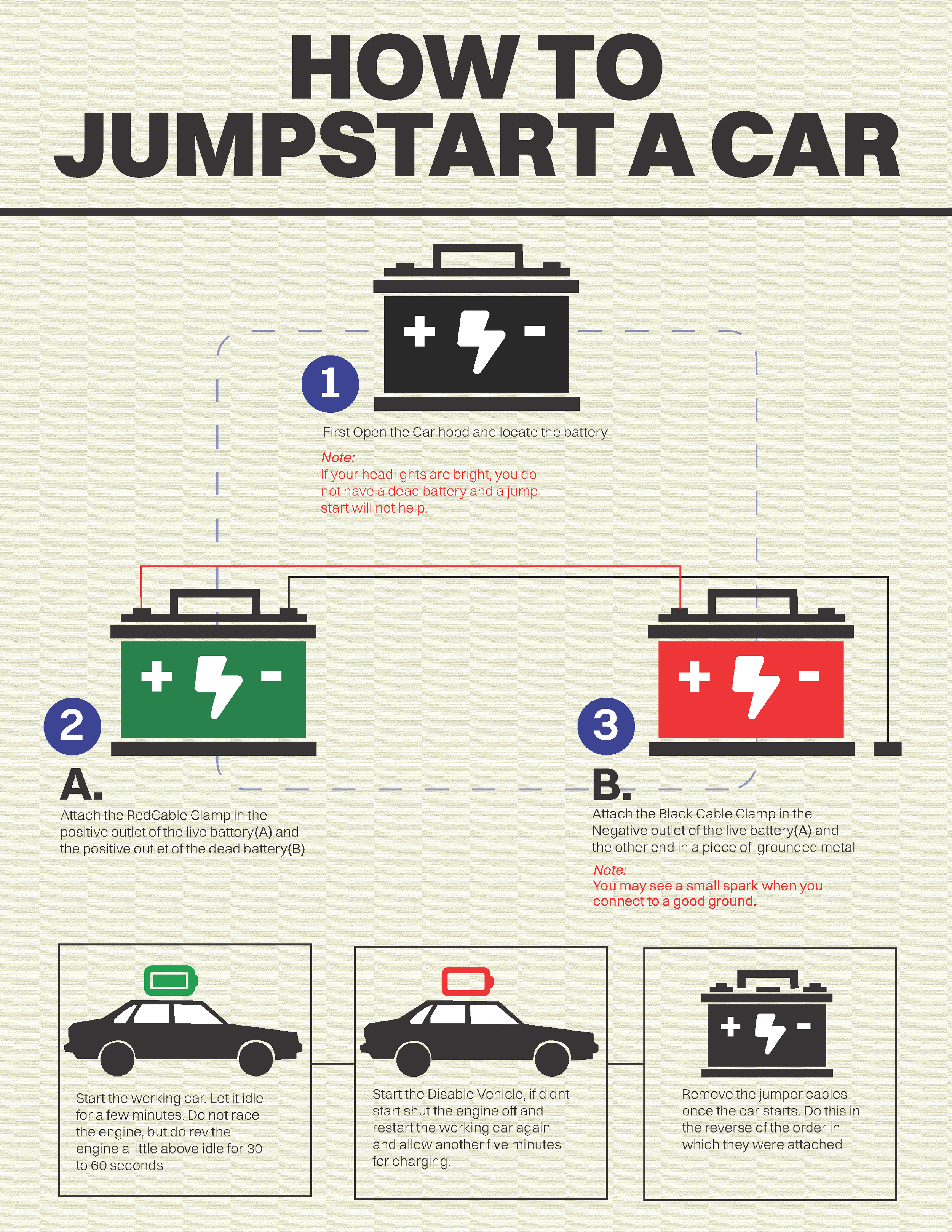
HOW TO JUMPSTART A CAR
INSTRUCTIONAL SEQUENCE
This instructional sequence is a design project that educates the target audience on how to jump-start a car. The design was inspired by the instruction manual most commonly seen in tech products. I picked a sans-serif typeface to keep it simple and clean. More importantly, I want the design to feel more cohesive, so I use broken and solid lines as guidelines to guide the viewer's eye, and I use color to associate objects with a conditioned symbol meaning, such as green for full and red for empty.
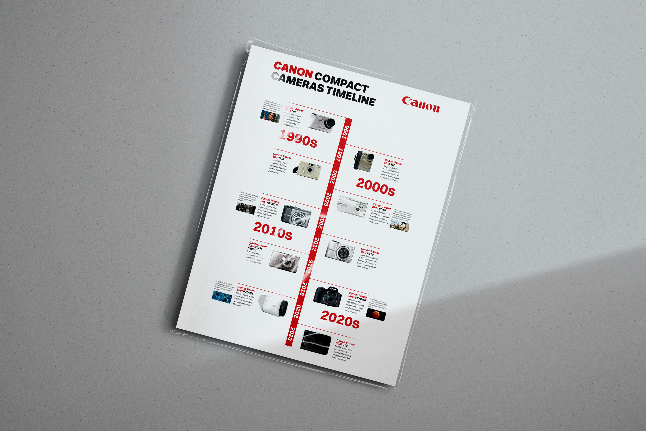
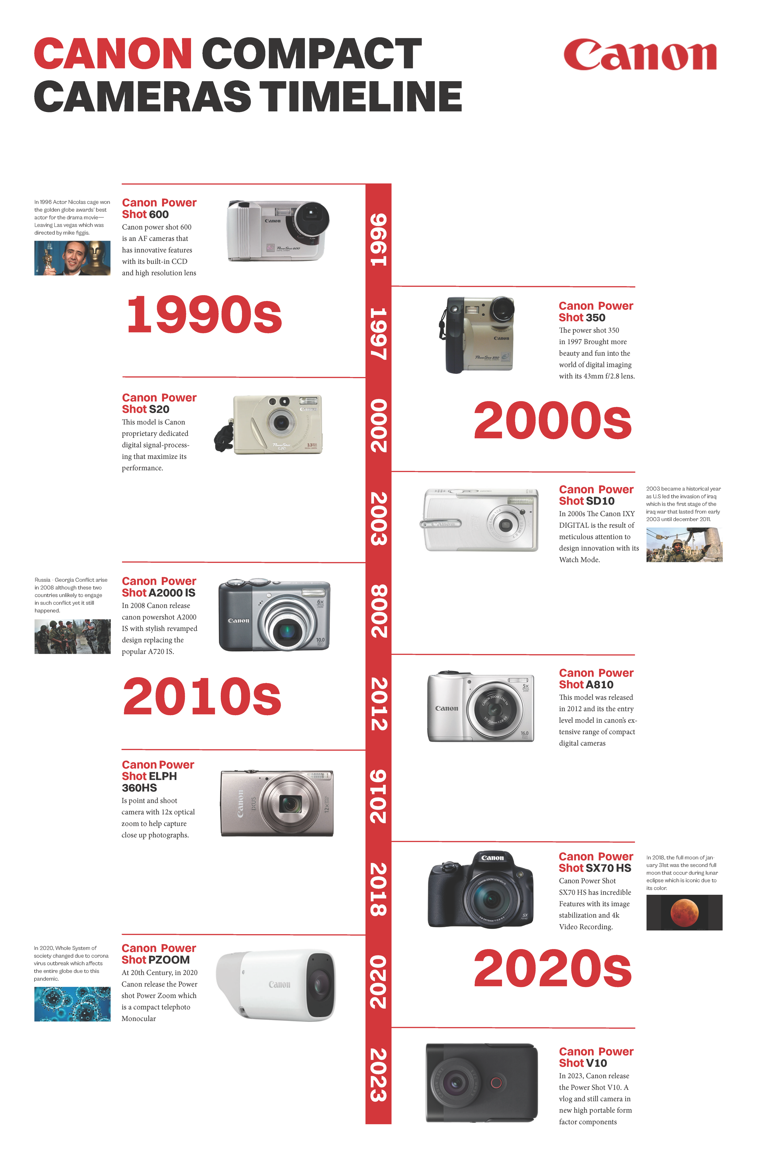
CANON COMPACT CAMERAS
INTERPRETIVE TIMELINE
The Canon compact camera timeline is an information design that illustrates how Canon compact camera product design has evolved over time. Concurrently, it showcases important events that correspond each year, creating a timeline that jointly interprets both subjects. The design was attributed to the main branding of Canon, using their primary color. On the other hand, a sans serif typeface was chosen to keep the design simple and easy to understand. The timeline was arranged vertically, from top to bottom, as the standard reading format in North America and Canada. Meanwhile, the compact camera images kept centered as primary information supported by correlated events as supporting details.
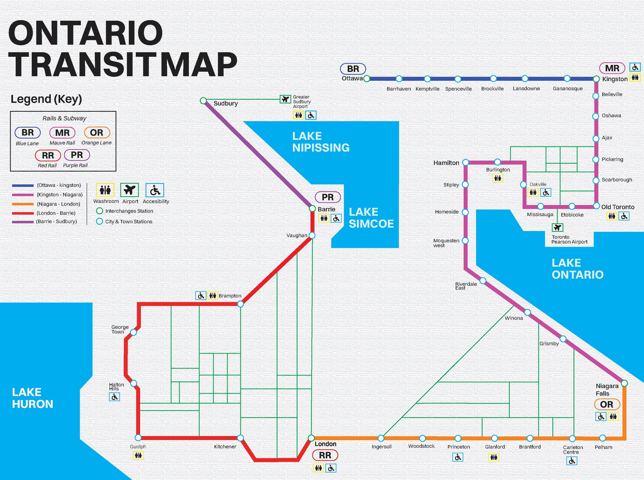
ONTARIO TRANSIT MAP
HYPOTHETICAL SITE MAP
This project is a hypothetical illustration of an Ontario transit map, designed to present map-based information and help readers understand selected geographic routes. The design combines iconography with visual language, incorporating basic geometric forms for clarity. It functions as a conceptual site map of Ontario, guiding readers through transit routes connecting cities such as Ottawa, Kingston, Niagara Falls, London, Barrie, and Sudbury. Each city features corresponding lines that are color-coded to represent distinct railways or subway systems. Lines, geometric shapes, and color are used alongside iconography—drawing from signage and wayfinding systems—to support the legend and help users easily distinguish and navigate the information presented.